 |
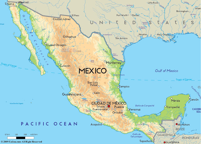
| Mexico Map, Mexico Physical Map |
Mexico Map, Mexico Physical Map
| Capital and largest city | Mexico City 19°26′N 99°08′W | |
| Official languages | None at federal level | |
|---|---|---|
| Recognised regional languages | ||
| National language | Spanish[b] | |
| Demonym | Mexican | |
| Government | Federal presidential constitutional republic[2] | |
| - | President | Enrique Peña Nieto(PRI) |
| - | Secretary of the Interior | Miguel Ángel Osorio Chong (PRI) |
| - | President of the Senate | Miguel Barbosa Huerta(PRD) |
| - | President of the Chamber of Deputies | Silvano Aureoles Conejo (PRD) |
| - | Supreme Court President | Juan Silva Meza |
| Legislature | Congress | |
| - | Upper house | Senate |
| - | Lower house | Chamber of Deputies |
| Independence from Spain | ||
| - | Declared | September 16, 1810[3] |
| - | Consummated | September 27, 1821 |
| - | Recognized | December 28, 1836 |
| - | First constitution | October 4, 1824 |
| - | Second constitution | February 5, 1857 |
| - | Current constitution | February 5, 1917 |
| Area | ||
| - | Total | 1,972,550 km2 (14th) 761,606 sq mi |
| - | Water (%) | 2.5 |
| Population | ||
| - | 2015 estimate | 121,736,809[4] (11th) |
| - | Density | 57/km2 (142nd) 142/sq mi |


0 comments:
Post a Comment